Water quality – Riverfly Monitoring
By regularly monitoring its plants and animals, we can find out how healthy the river is. The type and number of freshwater invertebrates (small aquatic insects and other creatures living in the river itself) found in a river are one of the best measures of a river’s health.
Riverfly Monitoring is a nationwide scheme, originally aimed at angling groups. Volunteers sample the populations of freshwater invertebrates at specific points every month. Over time, this allows a record of the river’s water quality and general health to be built up.
By using volunteers in this way, the water quality in a river can be checked much more frequently than if the monitoring was left to statutory organisations. As well as providing a general picture of the river’s health, it allows pollution events to be detected quickly and action taken to limit their impacts.
Plans are already underway to train a team of Riverfly volunteers, who will then monitor the invertebrates along the entire length of the Stort. Once monitoring is underway, the results will be posted here, so check back regularly!
The River Stort – a precious river under threat. It needs our help.
Welcome to the website of the Stort catchment partnership, and the home of the Stort Catchment Management Plan. Our Catchment Plan will improve the river for wildlife and for people. It will also help us to meet the UK's obligations under the Water Framework Directive.
The lower Stort
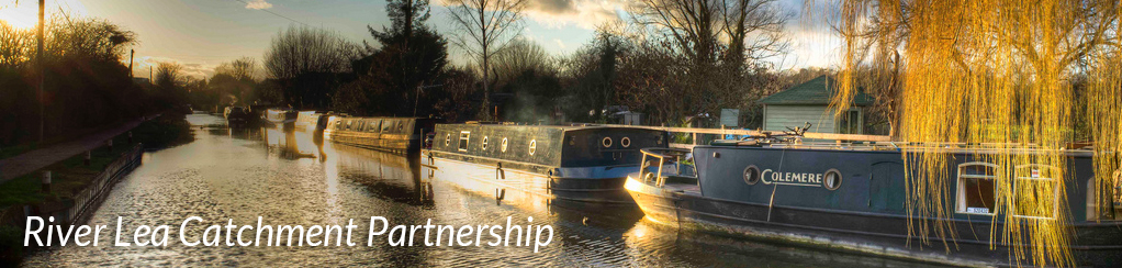
The lower Stort, upstream of the confluence with the Lea, has been made navigable by turning the original river into a canal (the ‘Navigation’). This allows boats to travel for 12 miles up to Bishop's Stortford. Historically, horse-drawn barges were used to transport timber and coal upstream, and grain and malted barley downstream to London.
Along this stretch the valley is characterised by wide flood plains, crossed by ditches and backwater streams. By far the greater part of this floodplain is pasture, used either for grazing or haymaking. Fortunately, there has been very little gravel extraction or other invasive industry.
Also in this stretch are several notable wetland nature reserves, including Hunsdon Mead, Parndon Moat Mead, May Meads Marsh, Sawbridgeworth Marsh, Thorley Wash and Rushy Mead. These reserves protect improtant areas of sedge, reedbeds, carr and wet grassland, and are characteristic of what much of the Stort Valley was like before the construction of the Navigation.
Large areas of this bottom section of the Stort experience regular flooding, particularly during the winter, and this attracts a wide range of waterbirds and waders on their autumn and spring migrations.
The Navigation channel itself is relatively poor habitat, having been subject to dredging and heavy overshading for many areas. The towpath is heavily used by the public, and the river experiences heavy boat traffic, with the associated disturbance to wildlife.
One of the main features of the lower Stort is the preservation of the Old River Stort in the form of backwater loops and meanders which were cut off when the canal was dug. These preserve the original character of the river and in many cases have picturesque gravel riffles and deeper pools. The backwaters are also home to some rare species, and typically form sanctuary areas for wildlife away from the busy Navigation.
Several brooks flow into this part of the Valley. On the east there is the Canons Brook, the Pincey Brook, the Little Hallingbury Brook and the Great Hallingbury Brook. These frequently bring with them excessive surface water run-off, plastic rubbish, nutrient rich water from sewage works and polluting run-off from agricultural land. The Great Hallingbury Brook in particular carries the treated effluent from the Bishops Stortford Treatment Works and contributes a large volume to the river flow on a daily basis.
On the west side of the valley there are the Eastwick Brook, Fiddlers Brook, Sawbridgeworth Brook and the Spell Brook. These drain mostly agricultural land but increasingly are subject to urban run-off, with its associated problems.
The upper Stort
At Bishop's Stortford the Navigation ceases, and for a short while we find the original River Stort in its channel. In a number of places there are characteristic gravel bed and riffles, with good water quality which supports trout.
The geology here has changed from boulder clay and gravel to chalk, and with this we find winterbourne streams and springs rising in the bed of the river.
Above Manuden the river is essentially a winterbourne stream, running only in times of high rainfall. The land here is predominantly arable with cultivation taking place right the way down to the river channel. At Clavering the river reappears in the form of a pleasant brook, and continues to wind its way through fields towards Nuthampstead, via villages such as Starlings Green, Langley Lower Green and Further Ford End. The source of the Stort is located in a lake some 10 miles away from Bishop's Stortford.
Projects needing funding
Several of the projects detailed in this plan are ready to start as soon as funding is obtained. If you have any suggestions for potential sources of funding, please This email address is being protected from spambots. You need JavaScript enabled to view it..
Projects needing practical help
Some of the projects will require some hands-on, practical help. If you can give your time and fancy getting involved with practical work in and around the river, this could be for you!
We will post information here as projects require help. Please check back regularly for details.